South Pole
In August 2023, the Indian spacecraft Chandrayaan-3 made the world’s first soft landing near the south pole of the Moon. During the mission temperatures on and beneath the surface of the regolith were measured, and its spectral composition was studied. At the same time, the Russian automatic interplanetary station Luna-25 was heading to the south pole to study the regolith, exosphere and to work out safe landing technology. Unfortunately, during one of the orbital maneuvers, an emergency occurred and the spacecraft collided with the Moon without completing its assigned tasks. And yet, interest in exploring the lunar south pole does not end with these missions. In the current decade, a number of space programs such as Artemis, Luna, Chandrayaan, Chang’e and others are being carried out by different countries, the main goal of which is to establish a base on the Moon, as well as search for water ice in the permanently shadowed regions of the lunar south pole. Therefore, in the near future, additional knowledge about these regions will be highly relevant and in demand.
Observation Schedule
| Date | Window, UT | Receiver |
Transmitter |
Frequency, MHz |
λ, cm |
Ptx, kW |
|---|---|---|---|---|---|---|
| 2023 May 26 | 11:00 - 11:30 | RT-13 (Sw, Zv) | TNA-1500 |
7190.0 | 4.2 | 1.5 |
Range-Doppler radar images
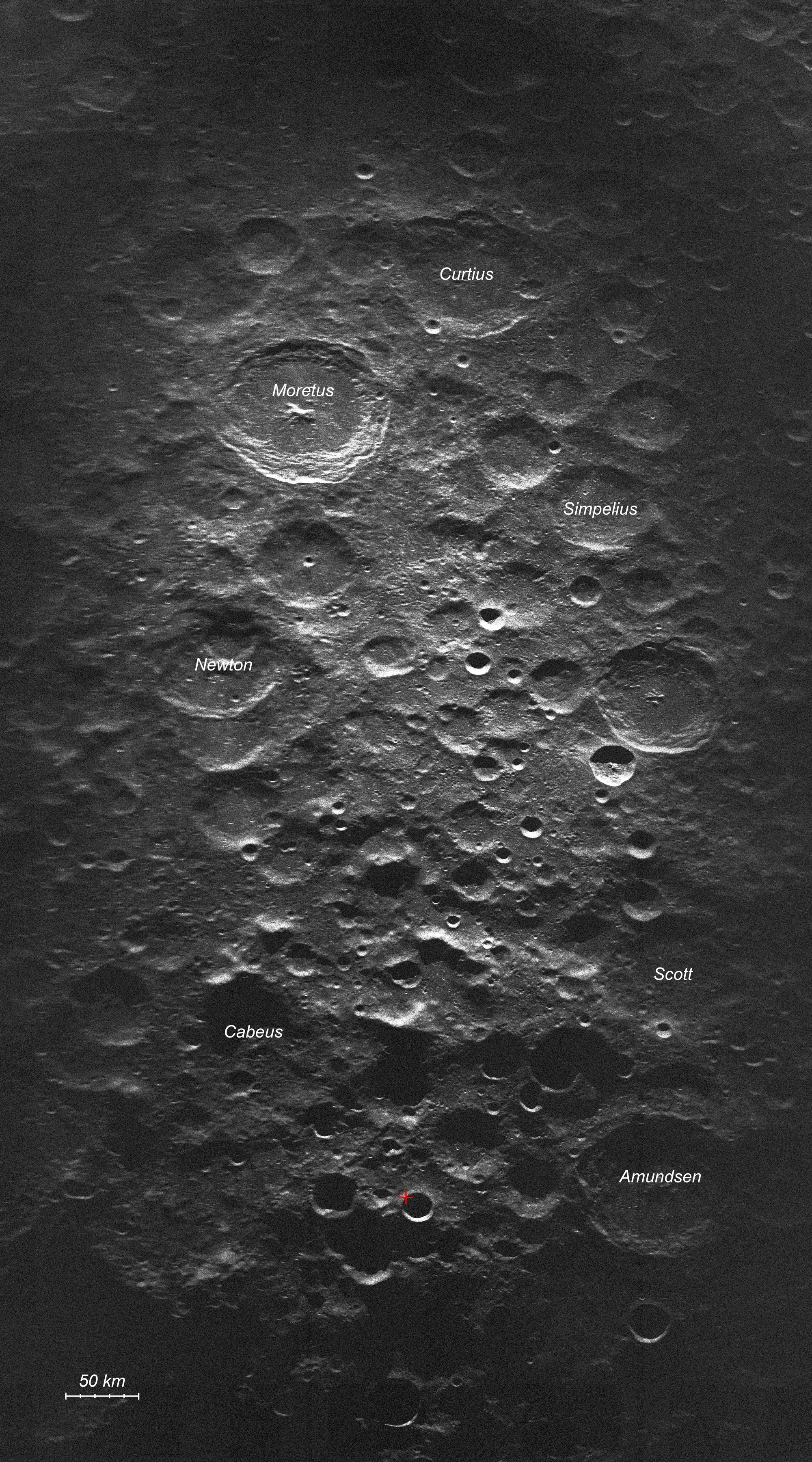
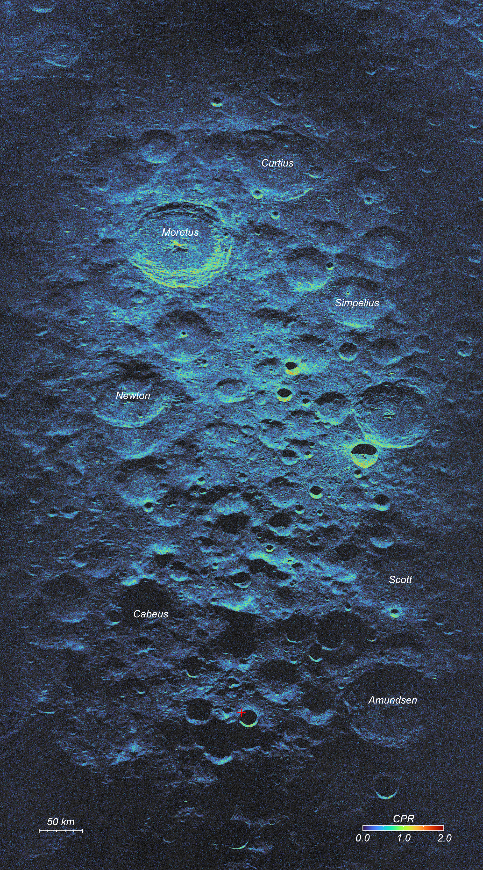
We present new radar images and polarimetric data that cover the southern polar region of the near side of the Moon measuring ~400x800 km with a spatial resolution of about 75 m [1]. The data were obtained using the 64-meter antenna (TNA-1500) of the Satellite Communications Center Bear Lakes of the Special Design Bureau of the Moscow Power Engineering Institute [2] and the 13.2-meter radio telescopes (RT-13) of the Svetloe and Zelenchukskaya Observatories of the Institute of Applied Astronomy, Russian Academy of Sciences, at a wavelength of 4.2 cm. At this wavelength, radar signals penetrate the lunar regolith to depths of up to 1 m and are sensitive to surface and suspended rocks larger than 1 cm. The maps show 40% of the area of permanently shadowed regions not observable by optical Earth-based instruments, which may hide water ice deposits. The data obtained as a result of this work can be used to study the surface and subsurface regolith features of the lunar south polar region, including searching for ice deposits in permanently shadowed regions, as well as for planning future lunar missions.
Remarks
We thank the technical staff of the SCC Bear Lakes of the SDB MPEI for the help with the radar observations.