Archimedes
A large ancient impact crater on the eastern edges of the Mare Imbrium.
Characteristics
| Selenographic Coordinates | 29.72° N, 3.99° W |
| Diameter | 81.04 km |
| Depth | 2.1 km |
Observation Schedule
| Date | Window, UT | Receiver |
Transmitter |
Frequency, MHz |
λ, cm |
Ptx, kW |
R, au |
RTT, sec |
SNR/RTT |
|---|---|---|---|---|---|---|---|---|---|
| 2021 Sep 1 | 10:00 - 11:00 | RT-13 (Sw) | DSA-3 [1] | 7190.0 | 4.2 | 0.2-2.0 | 0.00265 | 2.65 | ~382000 |
Range-Doppler radar images
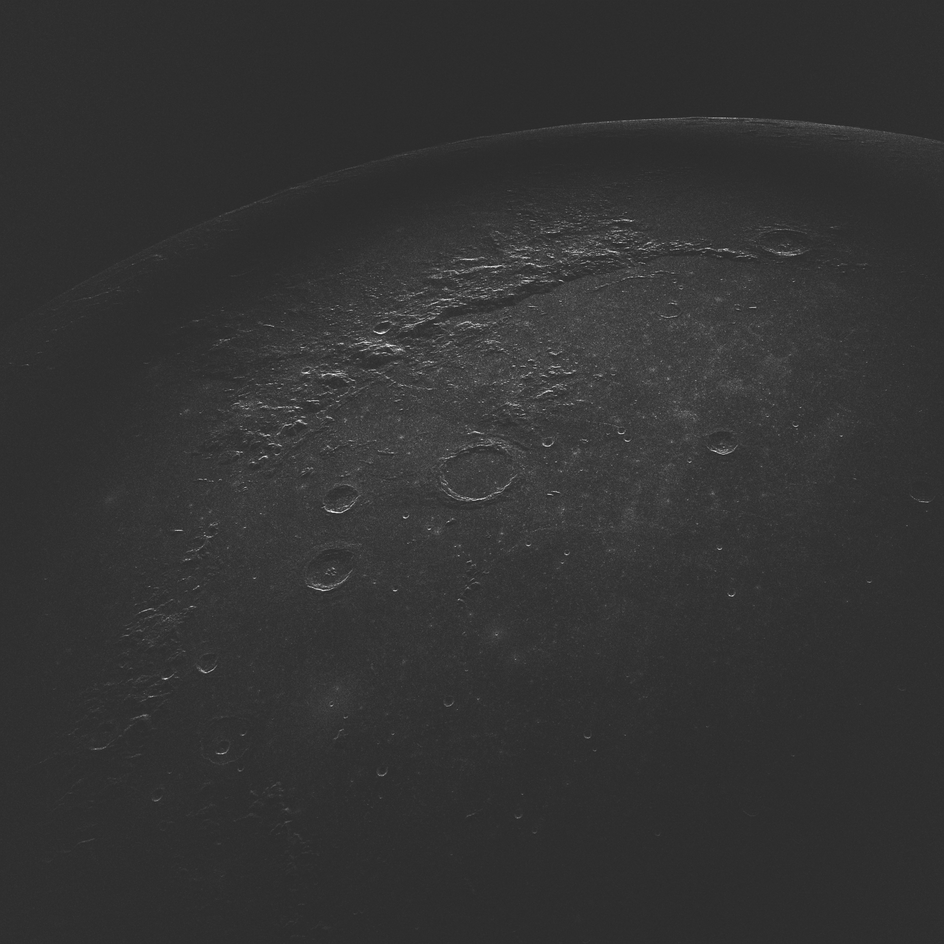
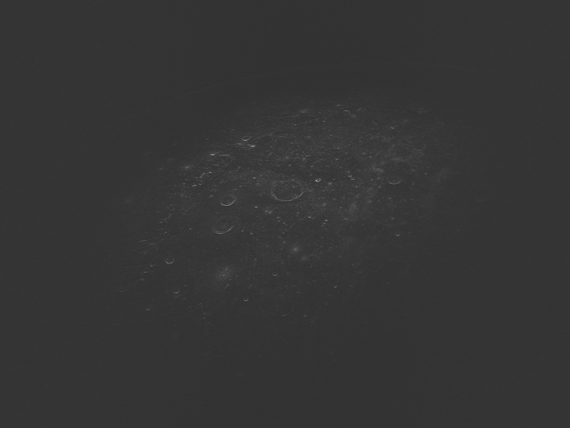
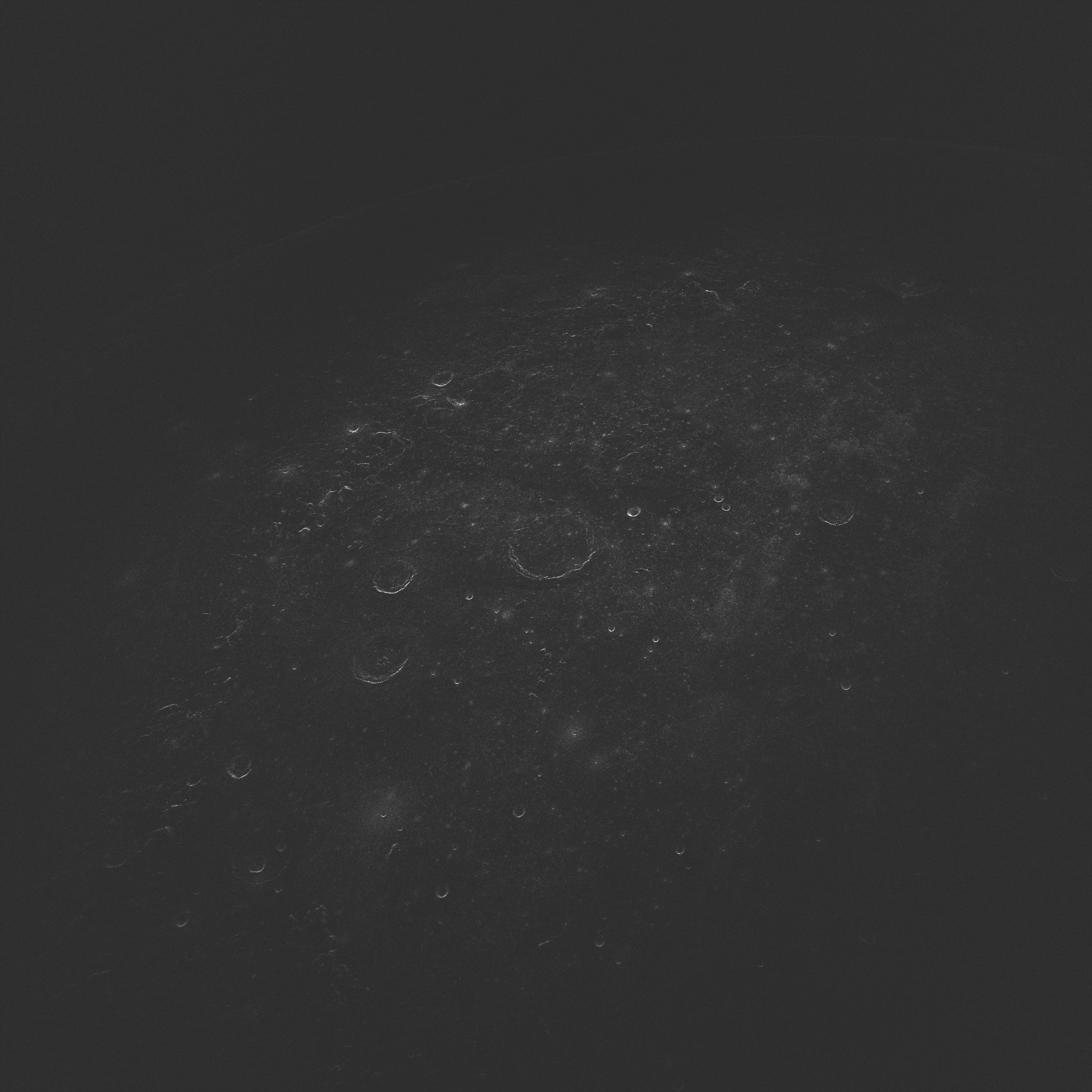
4.2-cm bistatic DSA-3/RT-13 range-Doppler radar images of Archimedes crater region obtained at Svetloe observatory on September 1, 2021. At this wavelength, radar signals penetrate up to one meter deep into the lunar regolith and are sensitive to surface and suspended rocks with a diameter of about 1 cm and larger. Range (distance from the observer) increases down and Doppler frequency increases to the right.
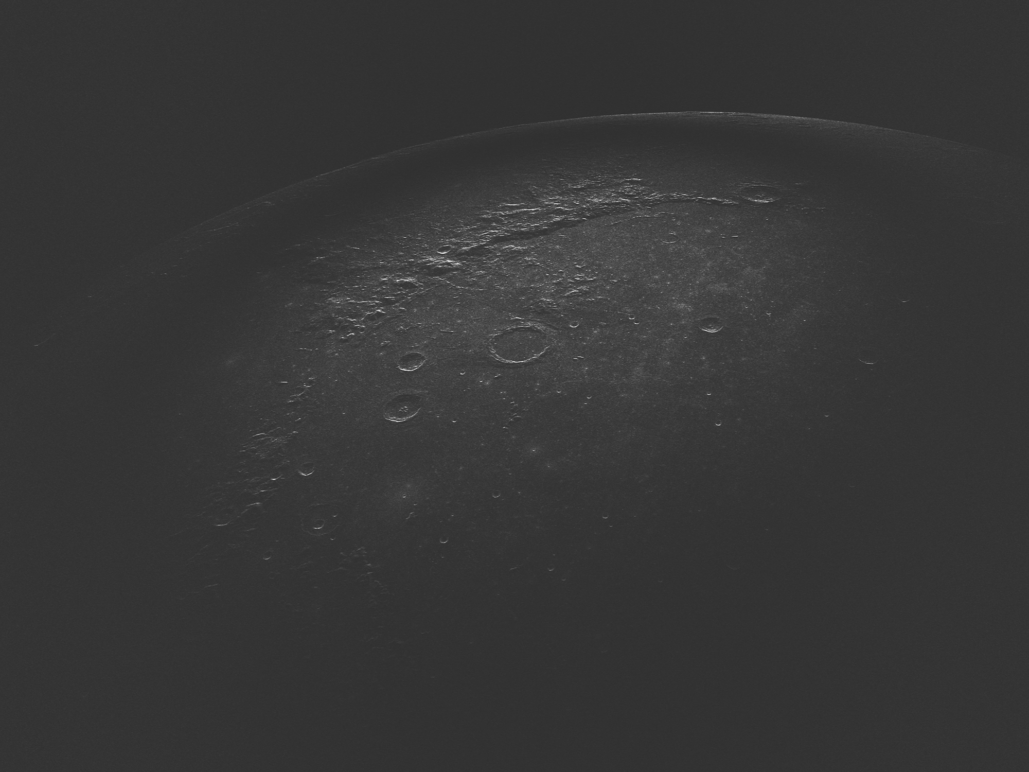
Opposite-sense circular polarization radar image of Archimedes crater region at 4.2-cm wavelength. (Download in high res.)
Same-sense circular polarization radar image of Archimedes crater region at 4.2-cm wavelength. (Download in high res.)
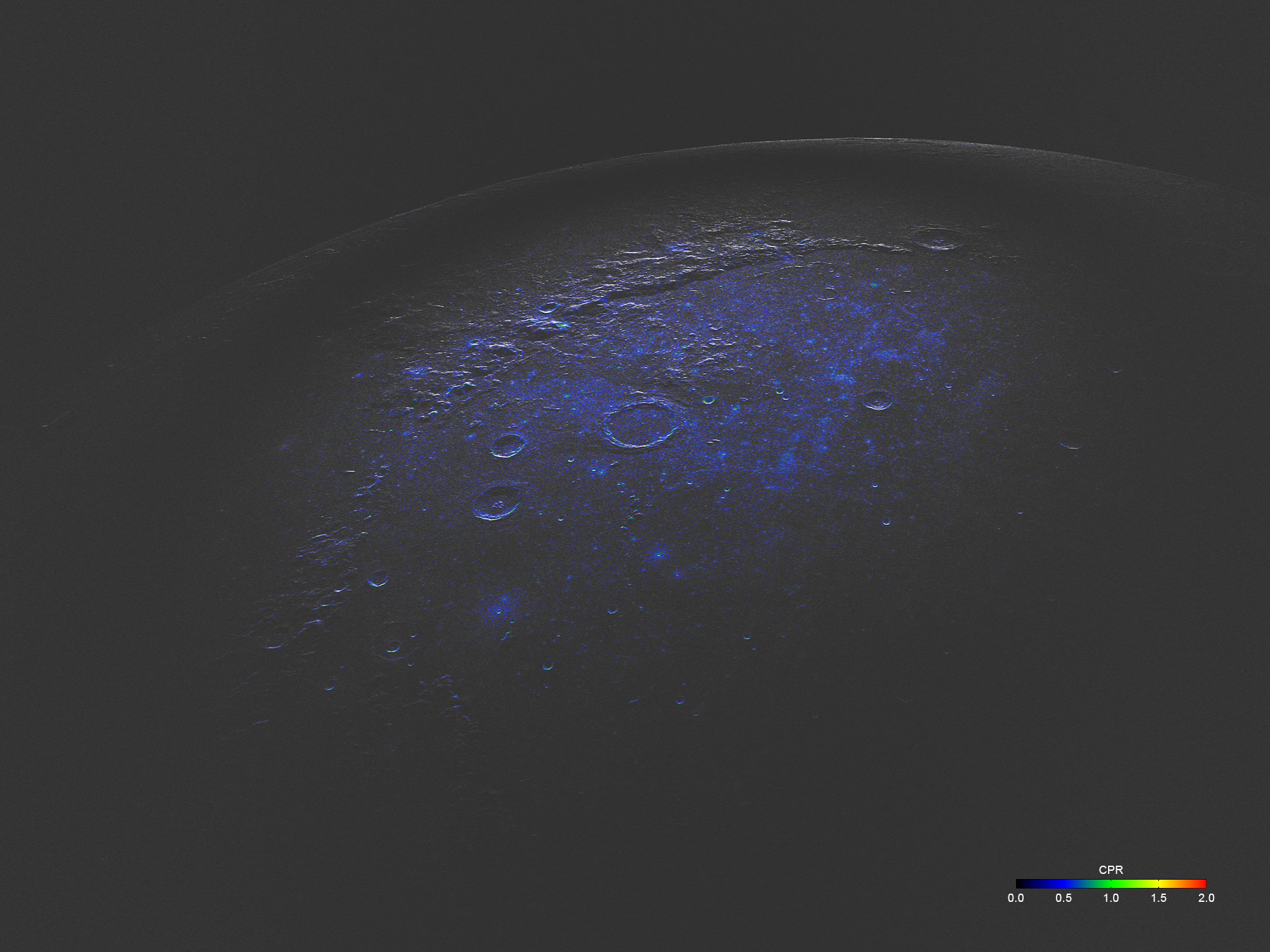
Radar image overlaid with the color tones of the circular polarization ratio (CPR) indicates the degree of surface roughness, rock abundance and material composition at the lunar surface and below. (Download in high res.)
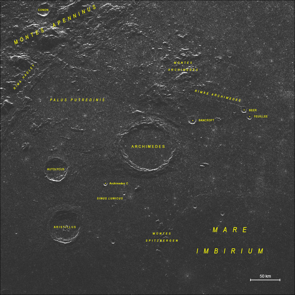
The Archimedes crater region on a radar image with a spatial resolution of about 300 m.
Remarks
We thank the National Commission on Space Activities of Argentina (CONAE) and the technical staff at Malargüe station for the help with the radar observations.